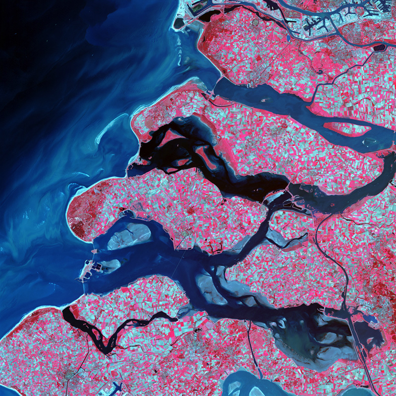
↑ Delta Region, Netherlands — Along the southern coast of the Netherlands, sediment-laden rivers have created a massive delta of islands and waterways in the gaps between coastal dunes. After unusually severe spring tides devastated this region in 1953, the Dutch built an elaborate system of dikes, canals, dams, bridges, and locks to hold back the North sea. Image courtesy of USGS National Center for EROS and NASA Landsat Project Science Office.
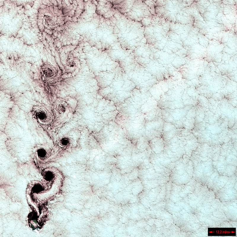
↑ Karman Vortices — Each of these swirling clouds is a result of a meteorological phenomenon known as a Karman vortex. These vortices appeared over Alexander Selkirk Island in the southern Pacific Ocean. Rising precipitously from the surrounding waters, the island's highest point is nearly a mile (1.6 km) above sea level. As wind-driven clouds encounter this obstacle, they flow around it to form these large, spinning eddies. Image courtesy of USGS National Center for EROS and NASA Landsat Project Science Office.
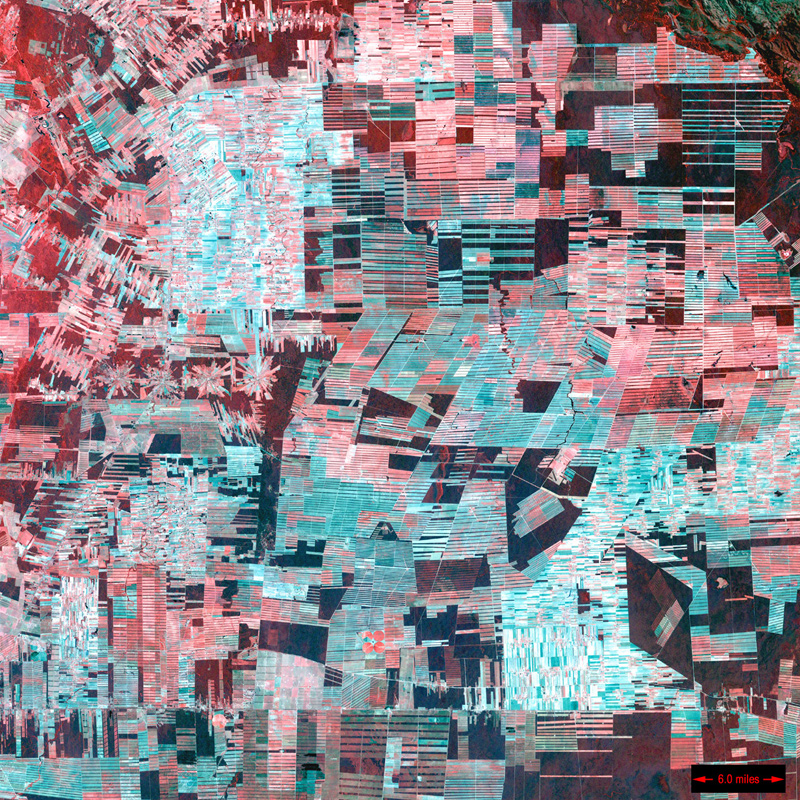
↑ Bolivian Deforestation — Once a vast carpet of healthy vegetation and virgin forest, the Amazon rain forest is changing rapidly. This image of Bolivia shows dramatic deforestation in the Amazon Basin. Loggers have cut long paths into the forest, while ranchers have cleared large blocks for their herds. Fanning out from these clear-cut areas are settlements built in radial arrangements of fields and farms. Healthy vegetation appears bright red in this image. Image courtesy of USGS National Center for EROS and NASA Landsat Project Science Office.
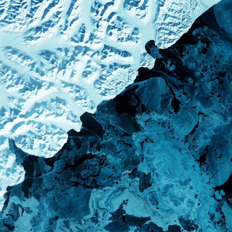
Kamchatka Peninsula— The eastern side of Russia's Kamchatka Peninsula juts into the Pacific Ocean west of Alaska. In this winter image, a volcanic terrain is hidden under snow-covered peaks and valley glaciers feed blue ice into coastal waters. Image courtesy of USGS National Center for EROS and NASA Landsat Project Science Office.
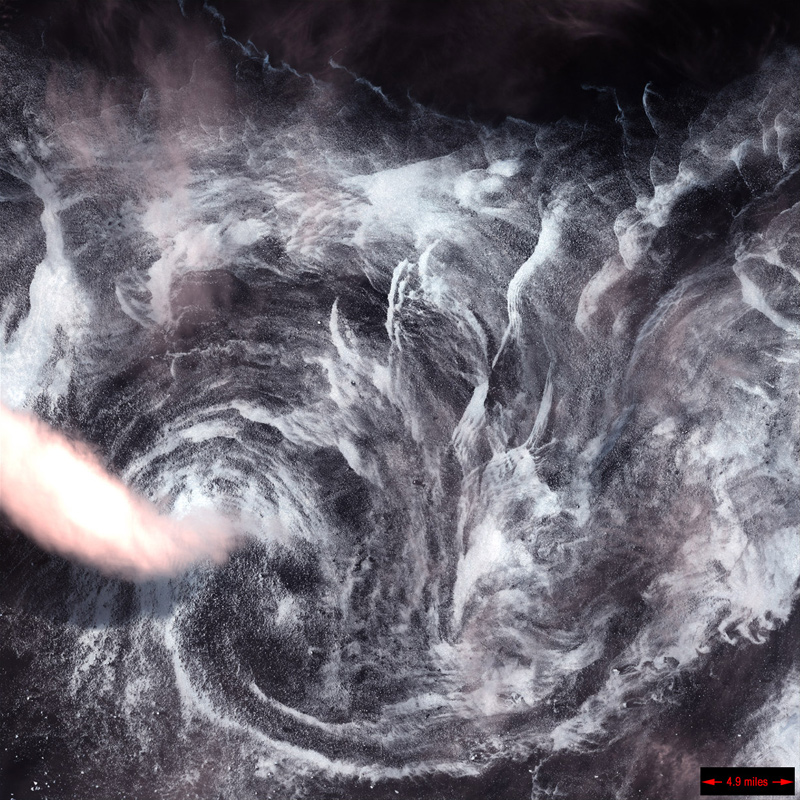
↑ Whirlpool in the Air — This image shows a spinning formation of ice, clouds, and low-lying fog off the eastern coast of Greenland. Image courtesy of USGS National Center for EROS and NASA Landsat Project Science Office.
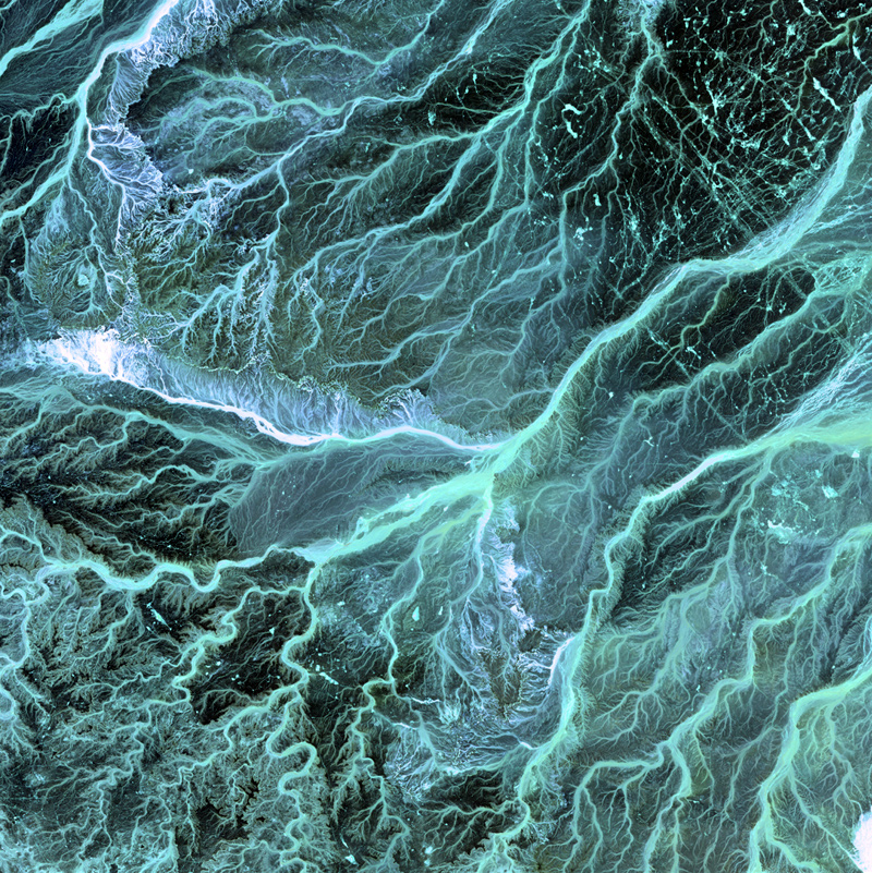
↑ Jordan — Meandering wadis combine to form dense, branching networks across the stark, arid landscape of southeastern Jordan. The Arabic word "wadi" means a gully or streambed that typically remains dry except after drenching, seasonal rains. Image courtesy of USGS National Center for EROS and NASA Landsat Project Science Office.
—
Related: David Maisel, Edward Burtynsky